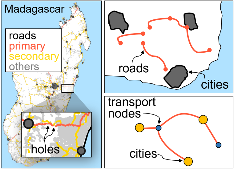
The road network that connects cities with the existing road infrastructure of a country is a valuable tool for analyzing its transport routes, connectivity, and urban patterns. Yet, it is challenging to construct, given the data available.
- We present a method to construct a simplified and connected urban network. Some network nodes are cities, and others are “transport nodes” representing road crossings or other types of infrastructure.
- The result is a simplified connected network of all cities and the existing road infrastructure that maintains road distances and available routes.
- The procedure reduces millions of spatial points that sometimes are disconnected polygonal lines or patches into a connected network with only a few edges and nodes.
https://www.sciencedirect.com/science/article/pii/S2215016122002254